E-Scouting 101
By Jordan Breshears
E-Scouting, what is it and why is it so important?
This is my take on it. We live in a fast-paced world and everything, even hunting, has morphed into something that requires maximum effort in minimum time slots. Can we ever replace boots on the ground scouting and hunting. NO, absolutely not, however, we can maximize our effectiveness with the tools available. And that is what e-scouting is all about.
This blog and the following in the series should give you my take on upping your e-scouting game and thus streamline your hunting trips and hopefully boost your odds in the field. Where do we start? You might think I am going to point you to onXmaps or TagHub 2.0 but we are not there yet.
Starting off, you need to know what you are hunting and where you are going. The typical narrowing down has to take place in order to spend effective time on satellite imagery. Are you expecting to draw a limited entry tag this year? If so, that is a great place to start. However, have you set up a “Plan B” in the event you don’t draw that tag? Okay, well maybe that is your next step.
I spend hundreds of hours per year searching for public land spots in general tag areas. That is my go-to each season. Primarily because I only apply for very hard to draw permits and end up hunting general tags the bulk of my hunting seasons.
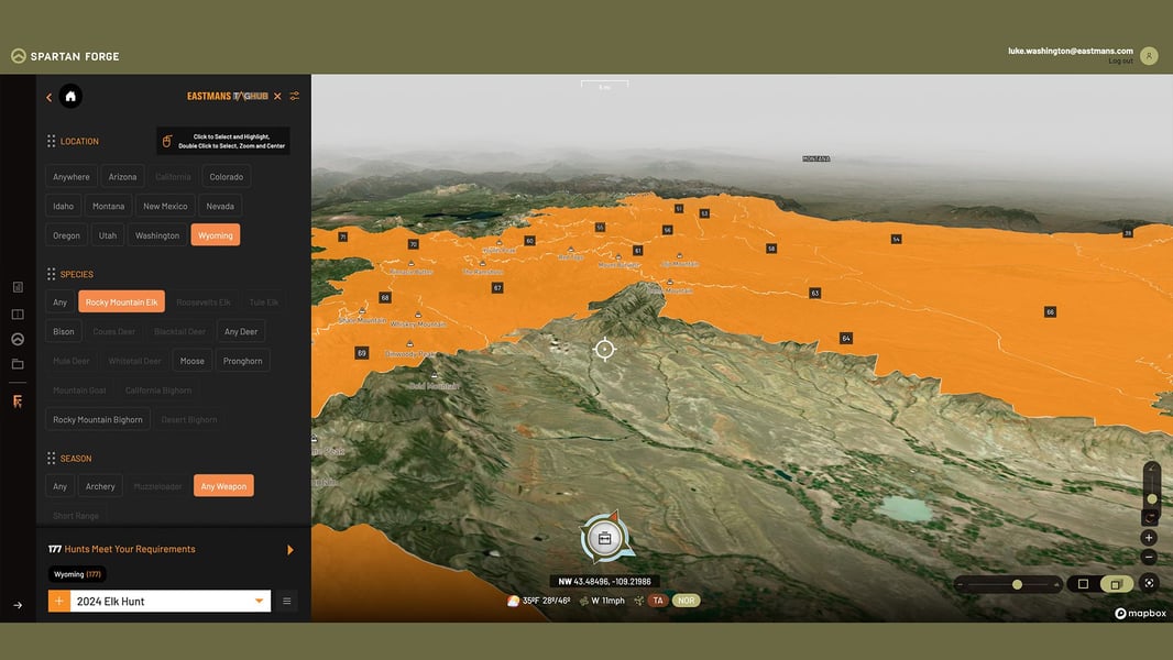
Okay, so step one: What and where – now that you have this information you can narrow it down to those specific hunt regions or units. Step two: get familiar with your e-scouting tools, i.e. onXmaps, TagHub 2.0 or even Google Earth at some level. Each is very effective and can really up your understanding of the areas you want to become familiar with. My go-to is a combination of onXmaps and TagHub 2.0, I feel like the filtering system on TagHub narrows your options and helps you decide the what and where part. While the land features and user-friendly layers with onX are second to none. Get on there and get familiar with it. Find your areas, narrow the public access points. Run in 3D mode and become familiar with the terrain, etc. If you aren’t running these programs with strong familiarity, you probably won’t spend the time needed to unravel your spots.
Takeaway: step one, what and where am I hunting? Step two: become familiar with your e-scouting tools, i.e. onXmaps and TagHub 2.0, get those under your belt and we will dive deeper next week!
If you aren’t certain about TagHub or onX maps, jump on eastmans.com and you can see our reviews and overviews of each product. Hopefully that clarifies for you and gets you started in the right direction!


